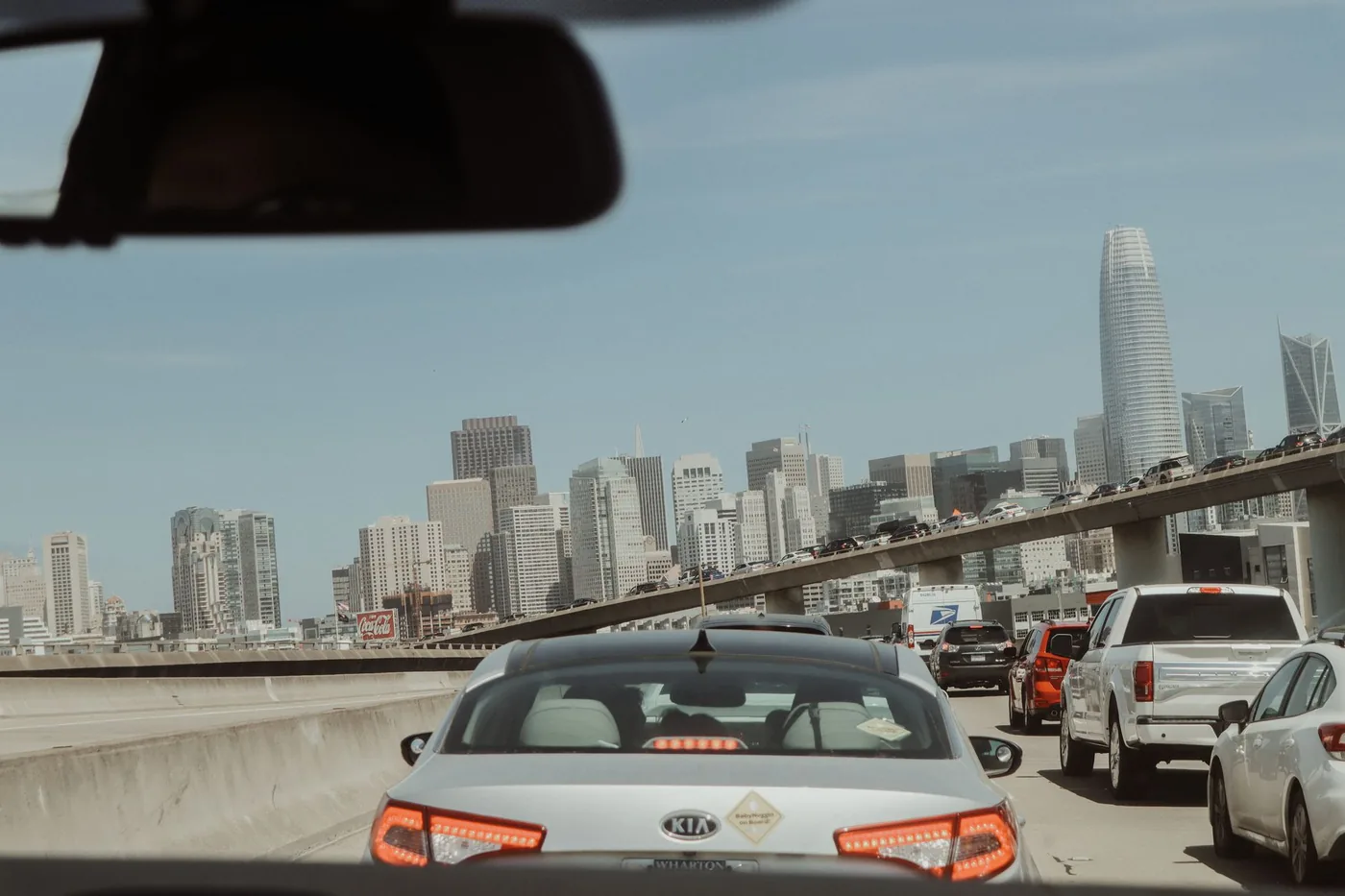
Roughly 90 miles of I-80 separate Sacramento from San Francisco. Two hours in ideal conditions, three and a half in bad ones — and the variable is not distance but two specific structures: the Yolo Causeway at the Sacramento end and the Bay Bridge at the other. How to choose drive vs train: every option compared. Eastbound evenings: San Francisco to Sacramento.
The short answer
- Distance: ~90 miles downtown to downtown
- Free-flow drive time: ~1 hr 40 min
- Typical weekday peak: 2 hr 15 min – 3 hr 30 min. Pattern estimates, not measured figures for today.
- Best departure window: 9:30 a.m.–2:00 p.m.
- Worst departure window: 6:30–9:00 a.m. westbound
- The two bottlenecks: Yolo Causeway (miles 5–15) and the Bay Bridge approach
The Yolo Causeway is the corridor's defining problem
More than 10,000 vehicles per hour travel I-80 in Yolo County during peak commute times, against a design capacity of about 2,000 vehicles per lane per hour. Caltrans figures put roughly 150,000 commuters across the causeway daily.
The structure itself makes it worse. The causeway is elevated above the Yolo Bypass with narrow lanes and no shoulders, which means there is nowhere to put a broken-down vehicle and no escape from a jam once you are on it. Caltrans District 3 and the Yolo Transportation District list contributing factors as high traffic volumes, short weaving and merging areas, lane drops, limited sight distances, and incomplete carpool, ramp-metering and auxiliary-lane networks.
A single crash on the causeway can produce westbound delays exceeding an hour. When that happens, the standard advice from local authorities is to leave the causeway alone entirely and take I-5 north to Woodland, then Highway 113 south to rejoin I-80 — a genuinely useful bypass most drivers do not know.
Active work: the Yolo 80 Managed Lanes Project is building a dynamically tolled express lane along 17 miles of I-80 between Davis and Sacramento, without expanding the causeway footprint. It is managed by the Capital Area Regional Tolling Authority. A separate $280 million pavement rehabilitation project has been running on the same stretch. Expect lane shifts and temporary barriers to be a feature of this drive for some time. Oakland-end timing without the bridge: Oakland to Sacramento.
Route options
I-80 — the default
The direct westbound line through Davis, Vacaville, Fairfield, and Vallejo, then over the Bay Bridge. About 90 miles, about 1 hour 40 minutes free-flow. Both bottlenecks are on it. Correct for most trips despite that.
Highway 113 via Woodland — the causeway bypass
I-5 north to Woodland, then Highway 113 south to rejoin I-80 near Davis. Longer, and the right call whenever the causeway is broken. Locals also use it routinely to dodge the 2:00–6:00 p.m. build. Worth learning before you need it.
I-580 / I-238 — the East Bay alternative
For destinations in the southern Bay Area or when the Bay Bridge approach is severely backed up. Not faster to downtown San Francisco under normal conditions, but a real option when the bridge is the problem rather than the causeway.
US 50 — the southern parallel
Runs parallel out of Sacramento and carries its own heavy peak demand. Caltrans notes the I-80/US 50 corridors are both subject to high travel demand during peak commutes and recreational weekend travel, so this is not an empty road — it is a second busy one.
When to leave
| Departure | Typical duration | Notes |
|---|---|---|
| Before 5:30 a.m. | ~1 hr 40 min | Free-flow both bottlenecks. |
| 5:30–6:30 a.m. | 1 hr 50 min – 2 hr 10 min | Causeway building. |
| 6:30–9:00 a.m. | 2 hr 30 min – 3 hr 30 min | Peak westbound. Causeway plus bridge. |
| 9:00–9:30 a.m. | 2 hr – 2 hr 20 min | Easing. |
| 9:30 a.m.–2:00 p.m. | 1 hr 45 min – 2 hr | Best window. |
| 2:00–6:00 p.m. | 2 hr 15 min – 3 hr | Eastbound is worse, but the causeway degrades in both directions from 2 p.m. |
| After 7:00 p.m. | ~1 hr 45 min | Clear. |
Commuters describe the causeway as bumper-to-bumper every day between roughly 2:00 and 6:00 p.m. If your trip touches that window in either direction, plan for it. Weekends are not a free pass. Caltrans specifically identifies recreational weekend travel as a demand driver on this corridor — Tahoe-bound traffic eastbound and Bay Area traffic westbound. Saturday mornings and Sunday afternoons carry real volume. City timing at the west end: best time to leave in San Francisco.
Weather on this corridor
Tule fog (November–February) is the serious one. Dense ground fog forms in the Central Valley and can drop visibility to near zero on the Davis–Sacramento stretch, including on the causeway where there is no shoulder to pull onto. Tule fog is a genuine hazard rather than an inconvenience.
Winter rain brings standing water and the first-rain oil-lift effect on a corridor already running above design capacity. Bay Bridge crosswinds affect high-profile vehicles. Summer is mostly benign on this route. General rain-and-traffic context: does rain make traffic worse.
The train alternative
The Capitol Corridor is a real option here, with one important caveat most guides bury.
- 168 miles, 17–18 stations, Auburn to San Jose via Sacramento and Oakland
- Up to 30 weekday round trips between Sacramento and Oakland in 2026, with 22 weekend round trips on the main segment
- Sacramento to Emeryville: under 2 hours (typically 1 hr 45 min to 2 hr)
- FY25 ridership: 1,138,753 — up 10.3%
- Fares increase from 1 September 2026 as part of the operator's business plan
The caveat: trains do not run directly into San Francisco. They terminate on the East Bay side, and you connect from Emeryville by Amtrak Thruway bus or local transit. That adds a leg, and it is the single thing that decides whether the train works for your trip. Current schedules.
Before you leave
The pattern on this corridor is unusually stable — the causeway is slow every afternoon, the bridge is slow every morning. What changes daily is whether there is a crash on the causeway, and that single event is the difference between a two-hour drive and a three-and-a-half-hour one. BoardSpy watches both bottlenecks, tells you before you leave whether the Highway 113 bypass is worth taking today, and factors tule fog and rain along the route into your departure recommendation.
Frequently asked questions
How long does it take to drive from Sacramento to San Francisco?
About 90 miles. Free-flow is roughly 1 hour 40 minutes. Weekday westbound peaks commonly run 2 hours 15 minutes to 3 hours 30 minutes when the Yolo Causeway and Bay Bridge both stack.
What is the best time to drive from Sacramento to San Francisco?
9:30 a.m. to 2:00 p.m., or after 7:00 p.m. Avoid 6:30–9:00 a.m. westbound. Before 5:30 a.m. is free-flow if you can leave that early.
What should I do if the Yolo Causeway is jammed?
Leave it. Take I-5 north to Woodland, then Highway 113 south to rejoin I-80 near Davis. Locals also use this bypass routinely in the 2:00–6:00 p.m. band.
Does the Capitol Corridor go to San Francisco?
No. Trains serve Sacramento to Oakland/Emeryville (typically 1 hour 45 minutes to 2 hours). You connect into San Francisco by Amtrak Thruway bus or local transit.
Is weekend I-80 easier?
Not reliably. Caltrans flags recreational weekend travel on I-80 and US 50. Saturday mornings and Sunday afternoons carry real volume, especially Tahoe-bound eastbound traffic.
References
Causeway operations sit with Caltrans District 3. Rail facts come from the Capitol Corridor operator. Timing tables are pattern estimates, not measured figures for today.
- Caltrans District 3 — I-80 / US 50 corridor, Yolo Causeway operations and District 3 projects including managed-lane work.
- Capitol Corridor — Operator page for Sacramento–Oakland/Emeryville service, Thruway connections, and fare changes.
- Capitol Corridor schedules — Current weekday and weekend frequencies.
- Data sources and privacy — How leave-time recommendations use your saved route (limits disclosed).