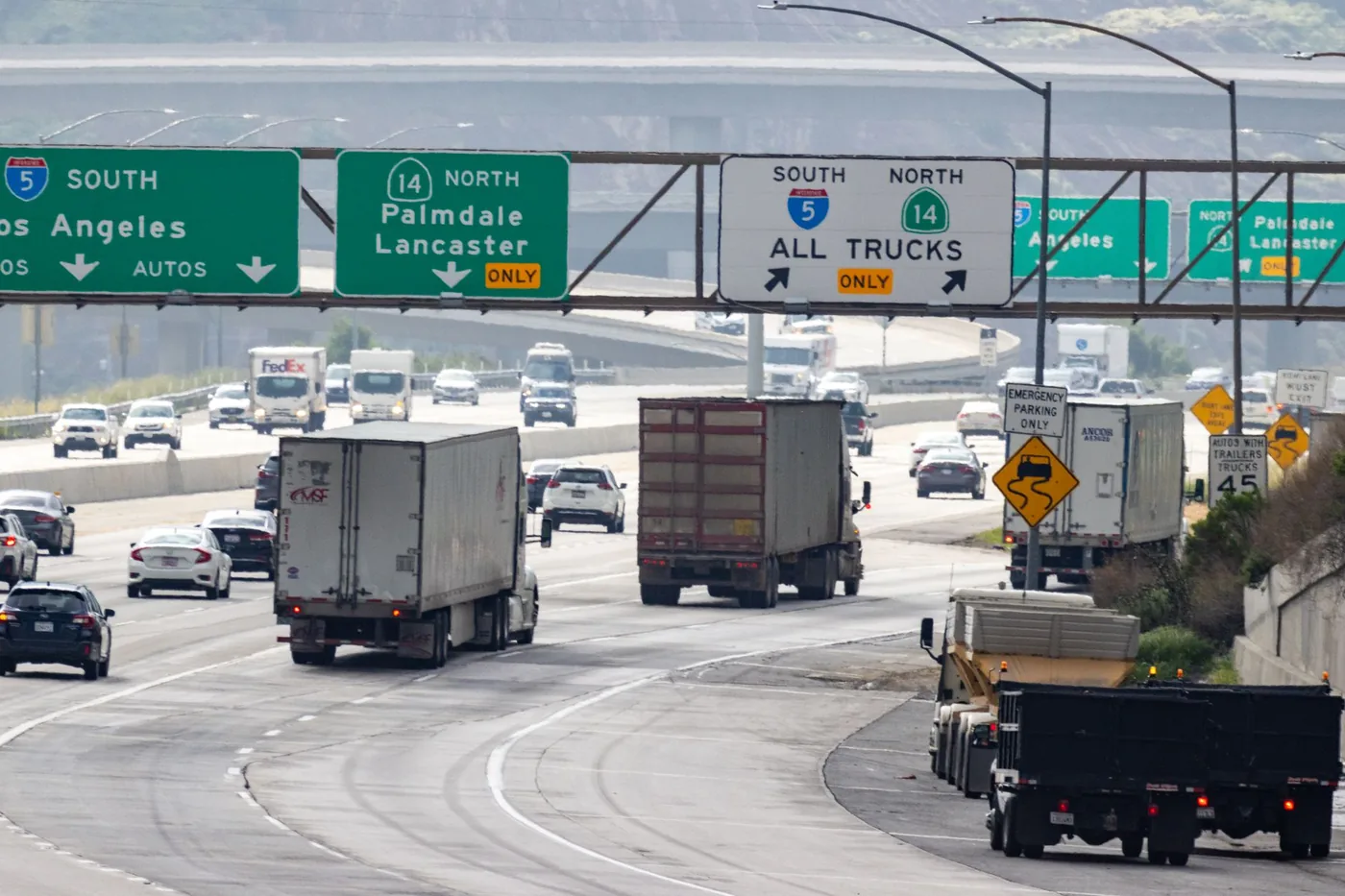
This page is for drivers crossing LA — I-5 from San Diego toward Sacramento, or I-10 coast to coast — not for people commuting within it. Here is what the agency data says, which route actually works, and when to be on it.
You are driving through the busiest road in America
The Federal Highway Administration publishes a ranking of the Top 25 Most Traveled Locations by Annual Average Daily Traffic. I-5 in Los Angeles sits at number one, at 504,000 AADT.
It is not close to being an outlier within its own metro. Ten of the twenty-five busiest highway locations in America are in the Los Angeles area — more than any other metro in the country:
| route | AADT | US rank |
|---|---|---|
| I-5, Los Angeles | 504,000 | 1 |
| I-5, Mission Viejo | 415,000 | 3 |
| I-405, Los Angeles | 383,500 | 4 |
| I-210 | 358,000 | — |
| I-10 | 355,000 | — |
| SR-60 | 350,000 | — |
| SR-91 | 319,000 | — |
| US-101 | 318,000 | — |
| I-110 | 315,000 | — |
| SR-57 | 308,800 | — |
One honest note on those numbers: FHWA's figures come from its Highway Performance Monitoring System and run higher than Caltrans' own segment counts, which put I-5's LA County maximum at 289,000 and I-405's at 329,000. The likely cause is how each agency defines a section. So treat FHWA for the national ranking and Caltrans for specific segment volumes, and do not mix the two in one sentence.
Caltrans publishes the peaks, and the weekend one surprises people
Caltrans District 7's Mobility Performance Report gives the windows directly:
- Weekday peaks: 6:30–9:00 a.m. and 2:30–6:00 p.m. Morning peak hour 8:00 a.m., afternoon peak hour 5:00 p.m.
- Weekend peak: 1:00–6:00 p.m., peak hour 4:00 p.m.
- Friday is the most congested weekday, followed by Thursday.
That weekend peak is the one that catches through-drivers. A Saturday afternoon crossing is not the easy option it feels like — it has a genuine peak of its own, and the afternoon peak hour is the same 4:00 p.m. either way.
District-wide in the second quarter of 2025, Caltrans measured 24.2 million vehicle-hours of delay at the 60 mph threshold. Four freeways account for 57% of the 35 mph delay: I-405 at 19%, I-5 at 14%, I-210 at 12% and I-10 at 12%.
Your two worst I-5 bottlenecks are both afternoon problems
From Caltrans' 2024 bottleneck table, the two on the I-5 through-route:
- I-5 northbound at Pasadena — PM peak. 572,637 vehicle-hours of delay, active 251 days of the year, average extent 3.10 miles.
- I-5 southbound at Downey — PM peak. 505,076 vehicle-hours, 222 days, average extent 2.11 miles.
Both PM. That is the practical argument for crossing in the morning gap rather than the afternoon one, if you have a choice: the afternoon peak is where I-5's own worst points sit.
The district's single worst bottleneck is on I-110 at Solano Avenue, PM peak, 779,806 vehicle-hours. Number two and three are both on I-405 — southbound at Howard Hughes Parkway in the PM, and southbound at Bel Air Crest in the AM.
I-405 is not the escape route it looks like
A common assumption is that I-405 goes around the congestion while I-5 goes through it. The data does not support that.
I-405 is a full parallel interstate: it leaves I-5 at the El Toro Y in Irvine and rejoins it in Sylmar, running about 72 miles against roughly 65 for I-5 between the same two junctions. So it is eight miles longer. And at its busiest point it carries more traffic than I-5 does at its busiest — 329,000 against 289,000 by Caltrans' own counts.
It also crosses the Sepulveda Pass at 1,129 feet, with a 5.5% maximum grade, where Caltrans measures 284,000 vehicles a day at Getty Center Drive. Caltrans ranks I-405 southbound at Bel Air Crest the third worst bottleneck in the district.
I-405 is a reasonable choice if your destination is on the west side. It is not a way to avoid LA traffic.
The only real bypass is nowhere near the city
If you genuinely want to skip Los Angeles, the route is I-15 north to SR-58 west, rejoining SR-99 or I-5 in the Central Valley. SR-58 runs 241 miles end to end and crosses Cajon Pass at 3,777 feet and Tehachapi Summit at 4,064 feet.
It is a long detour, but it is the only option that actually misses the metro — and Cajon Pass is more weather-reliable in winter than the Grapevine.
SR-14 and US-395 are not a bypass, despite being used that way. SR-14's southern terminus is at I-5 at Newhall Pass, which is inside the metro north of the San Fernando Valley. You have already crossed LA by the time you reach it. It is useful for Eastern Sierra destinations and nothing else, and it is not freeway throughout — north of California City it becomes a divided road with at-grade intersections.
The Grapevine: Caltrans closes it three to five times a winter
This is the part through-drivers underestimate, and Caltrans documents it thoroughly in its Operation Snowflake driver flyer.
I-5 crosses Tejon Pass at 4,144 feet, with a 6% maximum grade over about five miles. Caltrans states plainly: full I-5 closures from snow and ice occur an average of three to five times between October and April, typically lasting four to six hours, though some exceed 24 hours.
Chains are not allowed on the Grapevine. Caltrans' reason is that snow and ice are usually confined to the summit and there is nowhere practical to remove chains given the volume — and the flyer warns that drivers who don't use the pass regularly often carry no chains and don't expect snow at all.
Volume is the reason closures happen so readily. Caltrans measures roughly 84,000–89,000 vehicles a day across the pass, and at the Los Angeles/Kern county line 23,139 of them are trucks — 29.29% of all traffic, with 15,903 of those five-axle rigs. CHP's stated concern is that one accident in snow stalls hundreds of vehicles with that many big rigs on the road.
Caltrans runs the response in phases, and the later ones are worth knowing about:
- Phase 2 — snow sticking; CHP paces vehicles over the pass in escorted groups.
- Phase 3A — I-5 closed; SR-58 and SR-166 open as detours.
- Phase 3B — I-5 and SR-58 closed; SR-166 open.
- Phase 3C — all three closed; detour via SR-46 and SR-41 to US-101.
- Phase 3D — I-5, SR-58, SR-166 and US-101 all closed. No detours available.
Caltrans activates the alert when forecasters expect heavy snow down to 4,500 feet. Northbound closures happen at Lake Hughes Road in Castaic; southbound at Grapevine Road in Kern County. Caltrans does not forecast reopening times.
Check conditions at roads.dot.ca.gov, QuickMap, or CHIN on 1-800-427-7623 before committing to a winter crossing. See also how weather affects traffic.
Three things that catch through-drivers out
- Peak hour never really ends. At I-10's busiest point, the peak hour carries about 6.1% of the day's traffic against 4.17% for a perfectly flat distribution — a ratio of roughly 1.45. LA's volume doesn't drop away the way a smaller metro's does, which is why there is no genuine overnight window, only a quieter middle of the day. (That ratio is arithmetic from Caltrans counts, not a Caltrans finding.)
- Two freeways here ban trucks, and GPS doesn't always know. SR-110, the Arroyo Seco Parkway, bars commercial vehicles over 6,000 pounds for 8.2 miles from US-101 to Pasadena. SR-2 north of I-210 bars vehicles with three or more axles or 9,000 lb GVW. A routing app can send you up the 110 without warning.
- The interchanges are where the lane changes are forced. At the East Los Angeles Interchange, four routes meet in six freeway segments — I-5, I-10, US-101 and SR-60 — and Caltrans measures I-5 at 254,000 AADT approaching SR-60. At the Orange Crush in Orange and Santa Ana, I-5 meets SR-22 and SR-57; Guinness named it the most complex road interchange in its 2002 edition, and Caltrans records a peak hour of 30,500 there.
Find the best time to cross Los Angeles
Google Maps and Waze show live traffic once you are already driving. BoardSpy is the leave-time app: it checks your saved route before you leave, recommends when to go, and sends traffic and weather alerts for the road ahead — which matters more than usual on a route with a mountain pass on it. When you set off, it opens your map app for turn-by-turn. For how routing apps differ from departure-timing tools, see best app to avoid traffic.
Commuting in LA rather than crossing it?
This page is for through-traffic. If you drive in and around Los Angeles daily, the timing question is different — see the best time to leave Los Angeles. Heading north afterwards? Sacramento and San Francisco are the next stops on that run.
Frequently asked questions
What is the best time to drive through Los Angeles?
Before 6:30 a.m. or between about 9:00 a.m. and 2:30 p.m. on a weekday, which are the gaps between Caltrans District 7's published peaks of 6:30–9:00 a.m. and 2:30–6:00 p.m. Avoid Friday, which Caltrans names the most congested weekday, and avoid weekend afternoons, which carry their own 1:00–6:00 p.m. peak with a 4:00 p.m. peak hour.
Should I take I-5 or I-405 through Los Angeles?
I-5 unless your destination is on the west side. I-405 runs about 72 miles between the two junctions against roughly 65 for I-5, so it is eight miles longer, and at its busiest point Caltrans measures more traffic on I-405 than on I-5 — 329,000 against 289,000. Caltrans also ranks I-405 southbound at Bel Air Crest the third worst bottleneck in the district. I-405 is a route choice, not a congestion escape.
How do I actually bypass Los Angeles?
I-15 north to SR-58 west, rejoining SR-99 or I-5 in the Central Valley. SR-58 runs 241 miles and crosses Cajon Pass at 3,777 feet and Tehachapi Summit at 4,064 feet. It is the only route that genuinely misses the metro. SR-14 and US-395 do not bypass LA — SR-14 begins at I-5 inside the metro at Newhall Pass, so you have already crossed the city to reach it.
How often does the Grapevine close?
Caltrans states that full I-5 closures from snow and ice occur an average of three to five times between October and April, typically lasting four to six hours, though some exceed 24 hours. The pass crosses Tejon Pass at 4,144 feet with a 6% maximum grade. Caltrans activates its Operation Snowflake alert when heavy snow is forecast down to 4,500 feet.
Can I use chains on the Grapevine?
No. Caltrans does not permit chains on the Grapevine, because snow and ice are usually confined to the summit and there is no practical place to remove them given the traffic volume. Caltrans notes that drivers who do not use the pass regularly often carry no chains and do not expect snow there at all.
Which is the busiest road in Los Angeles?
By FHWA's national ranking, I-5 in Los Angeles is the busiest highway location in the United States at 504,000 annual average daily traffic. Ten of America's twenty-five busiest highway locations are in the LA metro. Caltrans' own segment counts are lower — a maximum of 289,000 on I-5 in LA County — because the two agencies define road sections differently.