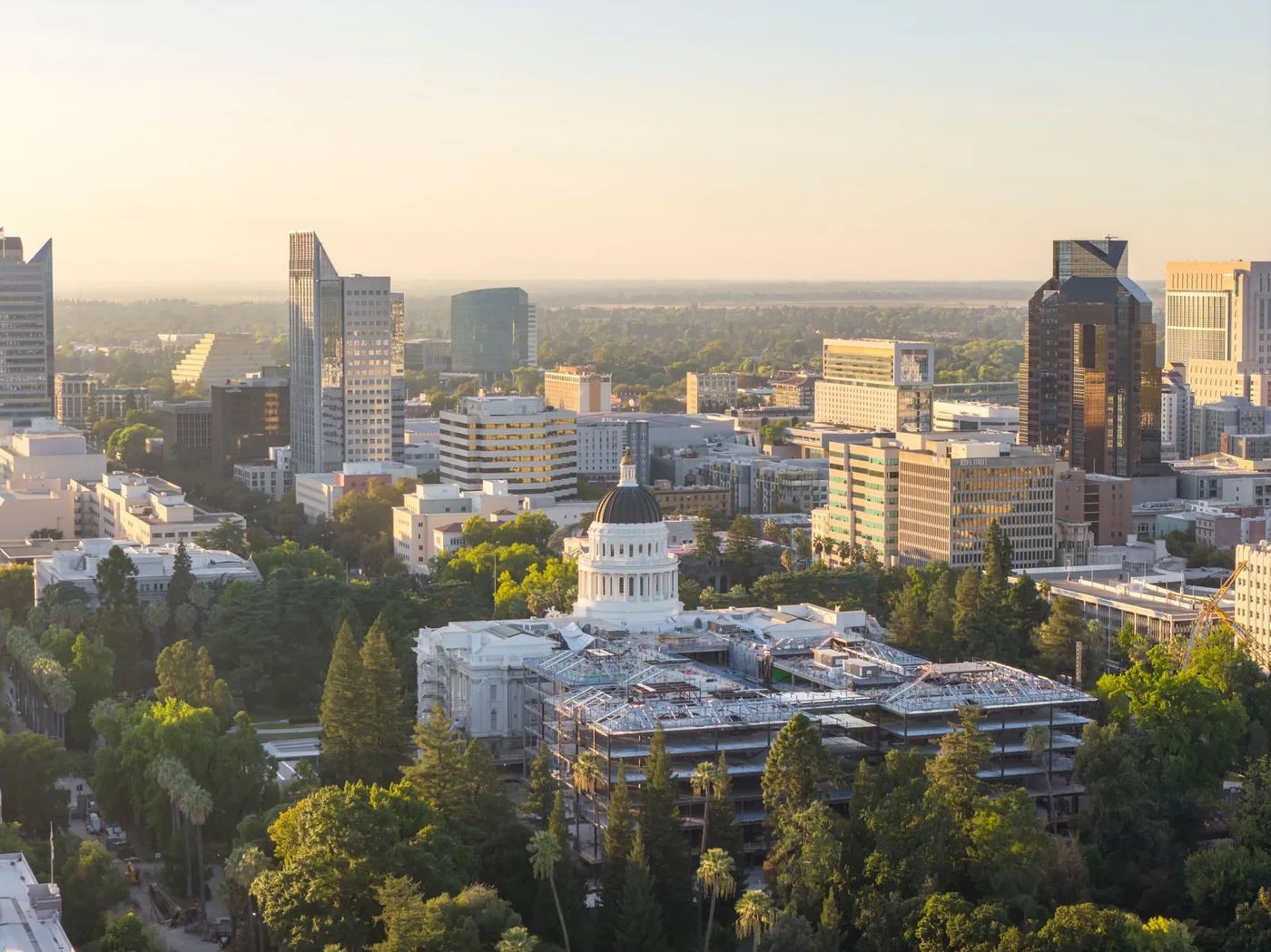
Sacramento is a flatter, easier drive than the Bay Area, and it has one genuinely strange piece of freeway and one weather pattern that nowhere else in the country has to plan around. Here is what the agency data says, when each corridor actually peaks, and how to find the best time to leave for your route.
The evening is the hard commute here, and Caltrans proves it
Caltrans District 3 publishes a quarterly Mobility Performance Report that ranks the region's bottlenecks by vehicle-hours of delay. In the Q4 2024 edition, all ten of the top bottlenecks occurred in the PM peak. Not most. All of them.
That is unusual enough to be worth building your week around. In most metros the morning and evening peaks trade places depending on the corridor. In Sacramento, the agency's own measurements say the afternoon is consistently where the delay is.
The second finding is just as useful: the worst road in the region is not I-5 or I-80. It is Business 80 / the Capital City Freeway, officially unsigned State Route 51 on its eastern half, which holds three of the ten worst bottlenecks — all in the evening:
| Bottleneck | Length | Delay (Q4 2024) |
|---|---|---|
| SR 51 southbound at Exposition Blvd | 2.05 mi | 65,408 vehicle-hours |
| SR 51 northbound, Elvas Underpass | 1.56 mi | 33,522 vehicle-hours |
| SR 99 southbound at Cosumnes | 2.01 mi | 28,255 vehicle-hours |
| SR 51 northbound at Fulton Ave | 2.29 mi | 27,122 vehicle-hours |
| I-5 southbound at Garden Hwy | 1.81 mi | 25,595 vehicle-hours |
| I-80 eastbound east of Mace Blvd | 3.03 mi | 23,694 vehicle-hours |
Caltrans also names its two worst-performing freeways in the district outright: I-80 in Sacramento County was the worst, and I-5 in Sacramento County the second worst.
For context, the Texas A&M Transportation Institute's 2023 Urban Mobility Report put Sacramento at 61 hours of delay a year per commuter, 26th of the 101 urban areas it studies intensively.
I-5 downtown sits in a trough that has to be pumped
This is the piece of Sacramento infrastructure almost no driver knows about, and it explains why repair work on I-5 downtown is such a recurring event.
Where I-5 passes downtown, the freeway runs in a depressed concrete structure that engineers call the "Boat Section." FHWA's own traffic management plan for the structure describes it plainly: the sections "function to resist the buoyant forces of surrounding groundwater," the seal slab "is sensitive to forces applied by groundwater, which is influenced by the Sacramento River stage elevations," and groundwater levels "are controlled during flood stages by a protective de-watering well system that activates at critical high elevations."
In short: a pumped well system keeps the river's groundwater from lifting a section of Interstate 5 off the ground. FHWA's report includes photographs of the Boat Section submerged during a January 1980 flood event, and notes the difficulty of working on it — "the high Average Daily Traffic (ADT) of 190,000 … and reduced shoulders on this section of the roadway make repair work difficult."
The reason it was built that way is the same reason the whole network looks the way it does. The Sacramento Area Flood Control Agency calls Sacramento "the most at-risk city in the country from riverine flooding," with more than half a million people in the floodplain and roughly 106 miles of levees and channels.
When is Sacramento traffic worst?
Caltrans District 3 uses AM peak 6:00–10:00 a.m. and PM peak 3:00–7:00 p.m. By corridor:
- Business 80 / Capital City Freeway (SR 51) — the worst road in the region, with three of the ten worst bottlenecks, all in the evening. Its Elvas Freeway core was built between 1950 and 1955 and widened from four lanes to six in 1965.
- I-5 through downtown — the north–south spine, running in the pumped Boat Section at 190,000 vehicles a day. Caltrans' top I-5 bottleneck is southbound at Garden Highway, evening peak.
- I-80 — Caltrans' worst-performing freeway in the district, bypassing downtown to the north.
- US 50, the W-X Freeway downtown and the El Dorado Freeway east — the commute to Rancho Cordova, Folsom and El Dorado Hills. The W-X Viaduct takes its name from running parallel to W and X streets.
- SR 99 — the southern suburban route; worst southbound at Cosumnes in the evening, i.e. outbound toward Elk Grove.
- I-80 west over the Yolo Causeway — 3.2 miles across a deliberate floodway toward Davis, worst eastbound east of Mace Boulevard.
Prefer a leave-by time to a set of windows? Put your arrival time into the departure time calculator and it will work out when to go.
The simple move: shift off the peak
Leaving just before or just after the busiest window clears a large share of the delay. In Sacramento the asymmetry is the opportunity: if the agency's data says the delay sits in the afternoon, then moving your departure home by half an hour is worth considerably more than moving your morning departure by the same amount.
A corollary worth acting on: if you have any control over which direction you make a discretionary trip, the Caltrans bottleneck list is effectively a map of which direction to avoid after 3 p.m.
Winter fog arrives with the morning peak
Sacramento's distinctive weather risk is tule fog, and the timing is the problem.
The National Weather Service describes tule fog as a Central Valley radiation fog that requires "a cool, moist layer of air from the Pacific close to the surface, clear skies above and light winds," producing "exceptionally thick fog on many nights from late October through February." NASA's Earth Observatory adds the detail that matters for a commute: the fog "tends to form after sunset and becomes thickest just before dawn", thinning only as the air warms in daylight.
The NWS issues a Dense Fog Advisory when visibility "frequently drop[s] to one-quarter of a mile or less," typically for two hours or more. FHWA estimates that nationally, more than 38,700 crashes occur in fog each year, killing over 600 people and injuring more than 16,300.
Put those together and the Sacramento winter conclusion is uncomfortable: the thickest fog of the day and the start of the 6–10 a.m. peak arrive at the same time. Checking conditions before you leave matters more here in December than in June — see how weather affects traffic.
Three Sacramento-specific things that move the peak
- Mountain traffic runs through town. Both I-80 and US 50 are the routes to Tahoe and the Sierra, and Caltrans District 3 warns ahead of big weekends that drivers on both "should expect significant traffic and travel delays." Recreational flow loads the same two freeways as the weekday commute, on a different calendar.
- Four river crossings, two of them movable. Only four road bridges cross the Sacramento River in the Sacramento and West Sacramento area: the Pioneer Memorial Bridge (US 50), the Tower Bridge, the I Street Bridge and the I-80 crossing. The Tower Bridge is a vertical-lift bridge with a 209-foot lift span, and the 1912 I Street Bridge is a swing bridge whose replacement was still unfunded as of early 2024. Two of your four options can open for a boat.
- One job in eight is a state government job. Bureau of Labor Statistics data for the Sacramento–Roseville–Folsom metro puts state government employment at roughly 139,600 against about 1.11 million total nonfarm jobs. A single large employer with a shared calendar concentrates a lot of trips into the same windows.
Why your best time is route-specific
SR 51 southbound at Exposition does not peak like I-80 past Davis, an inbound trip is not an outbound one, and a December morning in the fog is not a June morning. Citywide advice smooths over exactly the differences that decide your drive. Nationally, the worst day of the week varies by city too.
Driving I-80 to the Bay Area rather than commuting locally? See the Sacramento to San Francisco I-80 traffic guide instead.
Find the best time to leave for your Sacramento route
Google Maps and Waze show live traffic and turn-by-turn once you are already on the road. BoardSpy is the leave-time app: it checks your saved Sacramento route before you leave, recommends when to go, sends traffic and weather alerts, and tracks delay and on-time stats including your best and worst days. When you set off, it opens your map app for turn-by-turn. For how routing apps differ from departure-timing tools, see best app to avoid traffic and Google Maps commute alternatives.
Nearby cities
Every metro is listed on Best time to leave by city.
Frequently asked questions
What is the best time to leave to avoid traffic in Sacramento?
Generally before 6:30 a.m. or after 9:30 a.m. in the morning, and outside 3:00–7:00 p.m. in the evening — the peak windows Caltrans District 3 uses. The evening matters more here than almost anywhere: in Caltrans' Q4 2024 bottleneck ranking, all ten of the region's worst bottlenecks occurred in the PM peak.
When is Sacramento rush hour?
Caltrans District 3 defines the morning peak as 6:00–10:00 a.m. and the evening peak as 3:00–7:00 p.m. The evening is the heavier of the two, and the worst single stretch is Business 80 / the Capital City Freeway rather than I-5 or I-80.
What is the worst road in Sacramento?
Business 80 / the Capital City Freeway, unsigned as State Route 51 on its eastern half. It holds three of the ten worst bottlenecks in Caltrans District 3, led by the southbound stretch at Exposition Boulevard at 65,408 vehicle-hours of delay in one quarter. Caltrans separately names I-80 in Sacramento County its worst-performing freeway and I-5 in Sacramento County its second worst.
Why does I-5 through downtown Sacramento need pumping?
The depressed section of I-5 downtown, known as the Boat Section, sits in a concrete structure whose seal slab resists the buoyant force of surrounding groundwater. FHWA documents state that groundwater there is influenced by Sacramento River stage elevations and is controlled during flood stages by a protective de-watering well system that activates at critical high levels. The section carried 190,000 vehicles a day as of the figures in that report, with reduced shoulders that make repair work difficult.
Is tule fog dangerous for commuting in Sacramento?
It coincides with the morning peak, which is the risk. The National Weather Service describes tule fog as a Central Valley radiation fog producing exceptionally thick fog on many nights from late October through February, and NASA notes it tends to form after sunset and be thickest just before dawn. The NWS issues a Dense Fog Advisory when visibility drops to a quarter of a mile or less. Nationally, FHWA estimates more than 38,700 crashes occur in fog each year.
How do I find the best time to leave for my Sacramento commute?
Use a leave-time commute app that reads your actual route rather than only a live map. BoardSpy recommends when to leave for your Sacramento route, sends pre-departure traffic and weather alerts, and tracks on-time performance and your best and worst traffic days. Download it here.