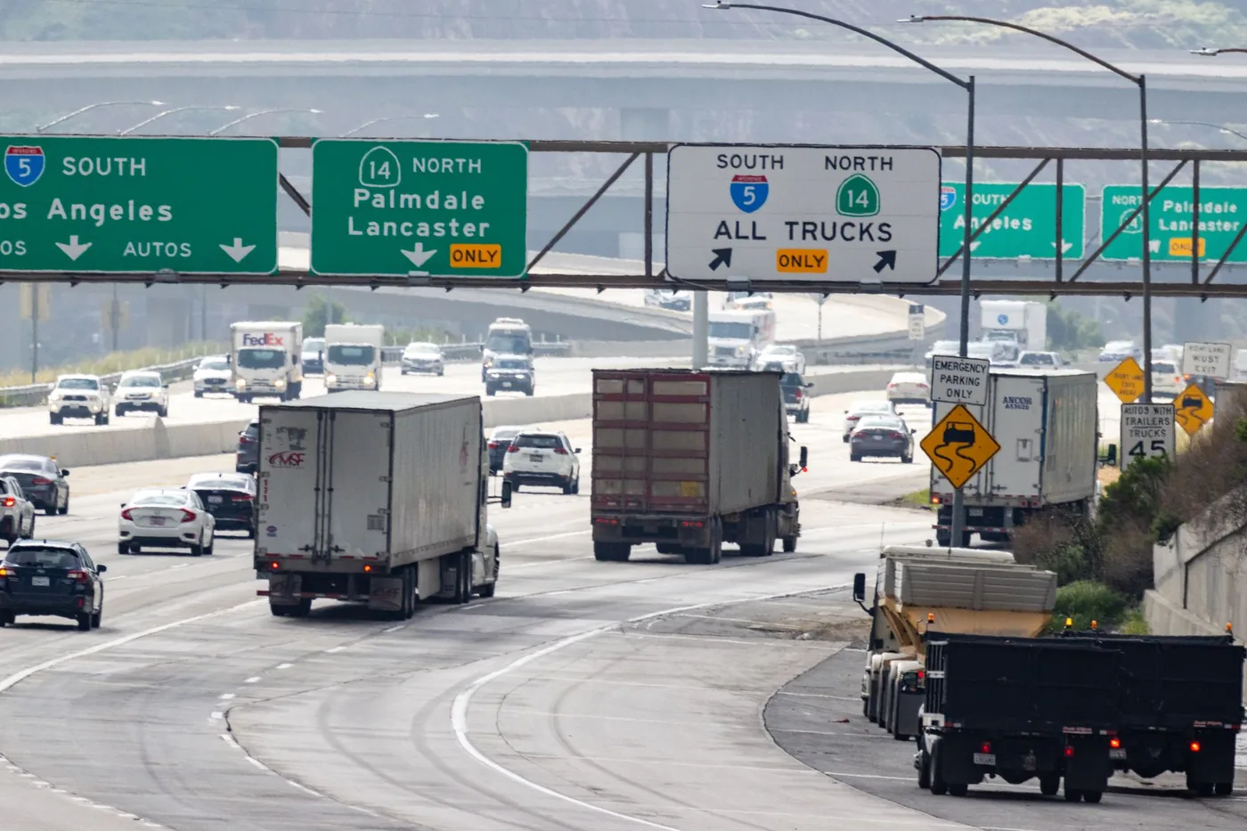
About 380 miles on I-5 and roughly six hours — or about 450 miles on Highway 1 and roughly ten, if you do it properly.
Those are two completely different trips, and choosing between them is the whole decision.
The three routes
| Route | Distance | Drive time | Character |
|---|---|---|---|
| I-5 | ~380 mi | ~6 hr | Fast, straight, dull |
| US 101 | ~430 mi | ~7 hr 30 | Middle ground, towns, wine country |
| Highway 1 / PCH | ~450 mi | ~10 hr+ | The coast. A destination, not a route. |
I-5 — the efficient one
Down the Central Valley through Bakersfield, Coalinga and Los Banos, then west toward the Bay.
Six hours in good conditions, and this is the correct choice when you need to arrive.
What it is like: straight, flat, hot in summer, and monotonous in a way that is genuinely worth planning around. The stretch between Bakersfield and Los Banos is one of the most low-stimulus drives in America, and low stimulus plus six hours is a fatigue profile, not just a boring afternoon.
The Grapevine — the climb over Tejon Pass north of Los Angeles — is the one piece of real terrain. It is also the corridor's main closure risk: snow and ice shut it several times most winters, and when it closes there is no convenient alternative.
US 101 — the compromise
Up through Ventura, Santa Barbara, San Luis Obispo, Paso Robles and Salinas.
Seven and a half hours, more interesting than I-5, and considerably faster than the coast road. It passes through real towns, wine country, and a coastal section around Santa Barbara that is genuinely beautiful.
For a trip where you want the drive to be pleasant but you also want to arrive the same day, this is the right answer.
Highway 1 — the coast
Big Sur, Bixby Bridge, the whole postcard.
Ten hours minimum, and realistically a two-day trip if you want to stop and look at anything — which is the only reason to take it.
Critical caveat: check the road status before you commit. Highway 1 through Big Sur closes regularly and sometimes for extended periods due to landslides. Sections have been shut for months at a time. Verify with Caltrans before you plan around it, and have a fallback.
Do not take Highway 1 because you are in a hurry and it looks shorter on a map. It is not shorter and you will not be in a hurry for long.
Timing your departure
The endpoints are the congestion; the middle is fine.
| Leave LA | Verdict |
|---|---|
| Before 6:00 a.m. | Best. Clears LA before the peak, arrives SF early evening. |
| 6:30 – 9:30 a.m. | Poor. LA's morning peak costs you 45 minutes before you start. |
| 10:00 a.m. – noon | Good. Both metros between peaks. |
| 1:00 – 3:00 p.m. | Marginal. Arrives into the Bay Area evening peak. |
| 3:00 – 7:00 p.m. | Worst. LA outbound peak plus a night arrival. |
LA's peaks run long — the evening build starts around 3 p.m. and does not clear until after 7. Getting out of Los Angeles is a bigger part of this trip than most people expect.
At the far end, arriving into the Bay Area between 4 and 7 p.m. adds real time, particularly if your destination requires the Bay Bridge.
Where to stop
Six hours needs at least two stops, and I-5's service spacing is uneven.
Grapevine / Lebec — the top of the pass, about 70 miles out. Fuel and food, and the last easy stop before the valley.
Bakersfield — about 110 miles. Full services, and the natural first proper break.
Kettleman City — about 210 miles, roughly the midpoint. The most substantial services on the I-5 valley stretch, and where most people stop.
Santa Nella / Los Banos — about 290 miles. Last good stop before the Bay Area approach.
The gaps between these are real. Do not pass Kettleman City on a quarter tank assuming something will appear.
On US 101, San Luis Obispo and Paso Robles are the natural breaks and are considerably more pleasant places to spend thirty minutes.
Weather
Tule fog (November–February) is the serious one. Dense Central Valley ground fog can drop visibility to near zero on I-5 with little warning. It is a genuine hazard rather than an inconvenience, and it is worst in the early morning — which is otherwise the best time to be driving.
Grapevine snow and ice close Tejon Pass several times most winters. Check the status before leaving in winter; when it closes, the detour is long.
Summer heat in the valley is extreme, and I-5 has long stretches where a breakdown leaves you exposed. Carry water.
Coastal fog on US 101 and Highway 1 is frequent in summer mornings, and on the cliff sections of Highway 1 it matters.
Driving it at night
Not recommended on I-5, for specific reasons rather than general caution: the monotony is worse in the dark, tule fog is far harder to detect, and the gaps between services mean a breakdown is a longer problem.
If you must drive part of it at night, do the LA-to-Bakersfield section in daylight and the valley run early rather than the reverse.
Is driving even the right call?
Worth asking. The LA–SF air corridor is one of the busiest in the country, with frequent short flights, and the drive is six hours before you account for stops.
Drive when: you want the car at the other end, you are travelling as a group, you are taking the coast route as part of the trip, or you have luggage.
Fly when: it is a short business trip and you do not need a car.
Before you leave
Six hours where the first and last are the variable ones, and a pass in the middle that closes without much notice. Leave windows: best time to leave Los Angeles to avoid traffic and best time to leave San Francisco to avoid traffic.
BoardSpy models the whole corridor — LA's outbound peak, the Grapevine, the valley, and your Bay Area arrival — with live tule fog and pass conditions on the road ahead rather than where you are standing.
Related BoardSpy guides
- Drive time from San Diego to San Francisco
- How far is Los Angeles to Long Beach
- Best time to leave in Los Angeles
Frequently asked questions
How long does it take to drive from LA to San Francisco?
About 380 miles and roughly six hours on I-5 in good conditions. US 101 is about 430 miles / 7 hours 30. Highway 1 is 450 miles and 10 hours or more. Pattern estimates, not live times.
Should you take I-5, US 101 or Highway 1?
I-5 when you need to arrive. US 101 when you want a pleasant same-day drive. Highway 1 only if the coast is the point — check Caltrans; Big Sur closes for landslides, sometimes for months.
When should you leave Los Angeles?
Before 6:00 a.m. is best. 10:00 a.m.–noon is good. Avoid 3:00–7:00 p.m. outbound. Arriving into the Bay Area between 4 and 7 p.m. adds time, especially if you need the Bay Bridge.
What closes this drive in winter?
The Grapevine (Tejon Pass) shuts several times most winters for snow and ice. Tule fog on I-5 in the Central Valley (November–February) can drop visibility to near zero, worst in early morning.
Where should you stop on I-5?
Grapevine/Lebec, Bakersfield, Kettleman City (midpoint — do not pass on a quarter tank), then Santa Nella / Los Banos. Service gaps in the valley are real.
References
Posted signs and operator timetables override this guide. Drive-time windows are pattern estimates, not measured figures for today.
- Caltrans road conditions — Live Grapevine / Highway 1 / I-5 closure status.
- Caltrans District 6 — Central Valley I-5, including tule fog and Tejon Pass.
- BoardSpy data sources — How leave-time recommendations use a saved route (limits disclosed).