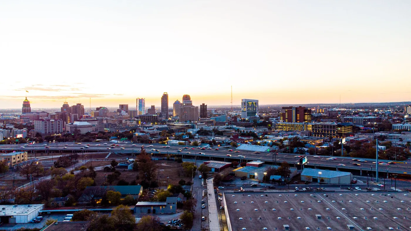
Most San Antonio commutes are genuinely easy, which is exactly why the handful of bad ones catch people off guard. Here is what the agency data says, when the real chokepoints peak, and how to find the best time to leave for your route.
Ten of Texas's hundred worst roads are here
Every year TxDOT and the Texas A&M Transportation Institute publish the Top 100 Most Congested Road Segments in Texas, built from INRIX speed data and TxDOT traffic counts. The 2025 edition, using 2024 calendar-year data, puts ten Bexar County segments on the list.
The worst of them is the one TxDOT labels "PanAm Expy / IH 35 / IH 10" — the 4.16 miles downtown between I-37/US 281 and US 90 where the two interstates share a single roadway. It ranks 43rd in the state, with 358,434 person-hours of delay per mile per year and an annual congestion cost of $42,485,375.
The dual designation is in TxDOT's own data, which is the point. This is not two highways near each other; it is one road doing two interstates' work while also carrying everyone driving into downtown.
Behind it:
| TxDOT rank | Segment | Annual delay per mile | Annual cost |
|---|---|---|---|
| 43 | I-35 / I-10 downtown (4.16 mi) | 358,434 hrs | $42.5M |
| 44 | I-35, Loop 1604 NE to I-410 NE | 354,461 hrs | $52.1M |
| 48 | I-410 north, US 281 to I-10 | 325,942 hrs | $39.2M |
| 56 | Loop 1604 north, US 281 to I-10 | 272,224 hrs | $58.8M |
Loop 1604's northern arc is the single most expensive piece of road in the region at $58.77 million a year in lost time and fuel, even though it ranks lower on delay per mile than the downtown overlap.
San Antonio traffic is actually improving
This is the part most traffic pages get backwards, and it matters for how you plan.
TxDOT reported in February 2025 that San Antonio-area traffic delay is down 21% over ten years while miles travelled rose 14%, worth roughly $278 million a year in regional time and fuel savings — about $350 per commuter. The clearest single example: US 281 North was once the most congested corridor in San Antonio and now sits at #2084 on the statewide ranking after its expansion.
So the honest framing is not that San Antonio is gridlocked. It is that the delay has been squeezed into a smaller number of predictable places. A commute that misses all of them is close to free-flowing. A commute that crosses one is where your whole week's lost time lives.
When is San Antonio traffic worst?
The Texas A&M Transportation Institute defines its peak periods as 6:00–10:00 a.m. and 3:00–7:00 p.m., and that is the window the Texas congestion rankings are built on. By corridor:
- I-35 / I-10 downtown — TxDOT's 43rd worst segment in Texas. Two interstates, one roadway, plus downtown access. The stretch worth checking before you commit to anything.
- I-35 north of I-410 — ranks 44th, and carries the Austin corridor commute plus freight. Inbound southbound in the morning, outbound northbound in the evening.
- I-410, the Connally Loop — a 49.5-mile complete inner loop whose northern arc does the real commuter work; the southern arc stays close to rural.
- Loop 1604, the Charles West Anderson Loop — the 95.6-mile outer loop. The north side between US 281 and I-10 is the costliest segment in the metro, carrying Stone Oak and Hill Country commuters.
- US 281, the McAllister Freeway — the north-side radial from Stone Oak into downtown, and the region's success story after expansion.
- US 90, the Cleto Rodriguez Freeway — the west-side radial into downtown, and the western boundary of that worst-ranked segment.
Prefer a leave-by time to a set of windows? Put your arrival time into the departure time calculator and it will work out when to go.
The simple move: shift off the peak
Leaving just before or just after the busiest window clears a large share of the delay. At 43 hours a year, San Antonio has less total delay to recover than Houston or Dallas — but because that delay sits in a few segments, shifting a trip that uses one of them pays better here than the citywide number suggests.
The downtown overlap is the exception to timing advice. There, what matters is the state of those four miles when you leave, because an incident on a shared roadway removes both interstates at the same moment and there is no parallel capacity to absorb it.
Your commute shares the road with Mexico's freight
This is the thing that makes I-35 through San Antonio different from a comparable urban interstate elsewhere.
Laredo, at the far southern end of I-35, is the busiest land port in the United States. In 2025 it handled 2,945,388 inbound truck crossings — 38.8% of every inbound truck from Mexico, out of 7,589,315 nationally. Nearly all of that volume runs north on I-35, straight through San Antonio.
Texas acknowledges the pressure directly: delivery trucks are prohibited from the leftmost lanes in both directions on I-35 across Bexar, Guadalupe and Comal counties. Your commute is sharing lanes with a national trade corridor, and that volume does not follow a commuter schedule.
Three San Antonio-specific things that move the peak
- The Austin corridor runs through your commute. I-35 between the two cities is one continuous stream of intercity, commuter and freight traffic. A problem in New Braunfels or San Marcos reaches San Antonio, and an incident on I-35 here is felt a long way in both directions.
- Joint Base San Antonio is a city inside the city. JBSA describes itself as the largest joint base in the Department of Defense, with three primary locations and around 80,000 members. The Texas Comptroller puts total direct employment at 74,713. Base gate hours and shift patterns shape traffic near Lackland, Fort Sam Houston and Randolph in ways no citywide rush-hour rule captures.
- Fiesta reshapes April. Fiesta San Antonio runs 11 days with over 100 official events and more than 2.5 million attendees, and an economic impact above $340 million. It is not a one-evening disruption; it is a week and a half of altered downtown traffic.
Why your best time is route-specific
The downtown overlap does not peak like Loop 1604's north arc, an inbound trip is not an outbound one, and a route that never touches TxDOT's ranked segments behaves nothing like one that crosses two of them. Citywide advice smooths over exactly the differences that decide your drive. Nationally, the worst day of the week varies by city too.
Driving the I-35 corridor north? See the best time to leave Austin for the other end of that run.
Find the best time to leave for your San Antonio route
Google Maps and Waze show live traffic and turn-by-turn once you are already on the road. BoardSpy is the leave-time app: it checks your saved San Antonio route before you leave, recommends when to go, sends traffic and weather alerts, and tracks delay and on-time stats including your best and worst days. When you set off, it opens your map app for turn-by-turn. For how routing apps differ from departure-timing tools, see best app to avoid traffic and Google Maps commute alternatives.
Just passing through?
This page is for commuters driving in and around San Antonio. If you are crossing the metro on the interstate rather than commuting within it, the timing question is different — see the best time to drive through San Antonio.
Nearby cities
Every metro is listed on Best time to leave by city.
Frequently asked questions
What is the best time to leave to avoid traffic in San Antonio?
Generally before 6:30 a.m. or after 9:30 a.m. in the morning, and outside 3:00–7:00 p.m. in the evening — the peak windows the Texas A&M Transportation Institute uses for its congestion measurements. Because San Antonio's delay is concentrated in a handful of segments rather than spread across the network, the bigger question is whether your route touches the downtown I-35/I-10 overlap, I-410 north or Loop 1604 north.
When is San Antonio rush hour?
Roughly 6:00–10:00 a.m. and 3:00–7:00 p.m. on weekdays, using TTI's peak-period definition. The heaviest stretches are the downtown I-35/I-10 overlap, I-35 north of I-410, and the northern arcs of I-410 and Loop 1604.
What is the worst road in San Antonio?
By TxDOT's 2025 ranking, the 4.16-mile downtown segment where I-35 and I-10 share one roadway, between I-37/US 281 and US 90. It is the 43rd most congested road segment in Texas, with 358,434 person-hours of delay per mile a year and $42.5 million in annual congestion cost. By total cost, the northern arc of Loop 1604 between US 281 and I-10 is worse at $58.8 million a year.
How bad is San Antonio traffic compared to other cities?
Milder than its size suggests, and improving. The typical San Antonio driver loses 43 hours a year to congestion against a 49-hour US average. TxDOT reports regional delay down 21% over ten years even as miles travelled rose 14%, saving roughly $350 a year per commuter. US 281 North went from the city's most congested corridor to #2084 statewide after expansion.
Why is I-35 through San Antonio so busy?
Because it is simultaneously a commuter route, the Austin–San Antonio intercity corridor, and the main freight artery from the Mexican border. Laredo at the southern end of I-35 is the busiest land port in the United States, handling 2,945,388 inbound truck crossings in 2025 — 38.8% of all inbound trucks from Mexico. Texas bars delivery trucks from the leftmost lanes across Bexar, Guadalupe and Comal counties as a result.
How do I find the best time to leave for my San Antonio commute?
Use a leave-time commute app that reads your actual route rather than only a live map. BoardSpy recommends when to leave for your San Antonio route, sends pre-departure traffic and weather alerts, and tracks on-time performance and your best and worst traffic days. Download it here.