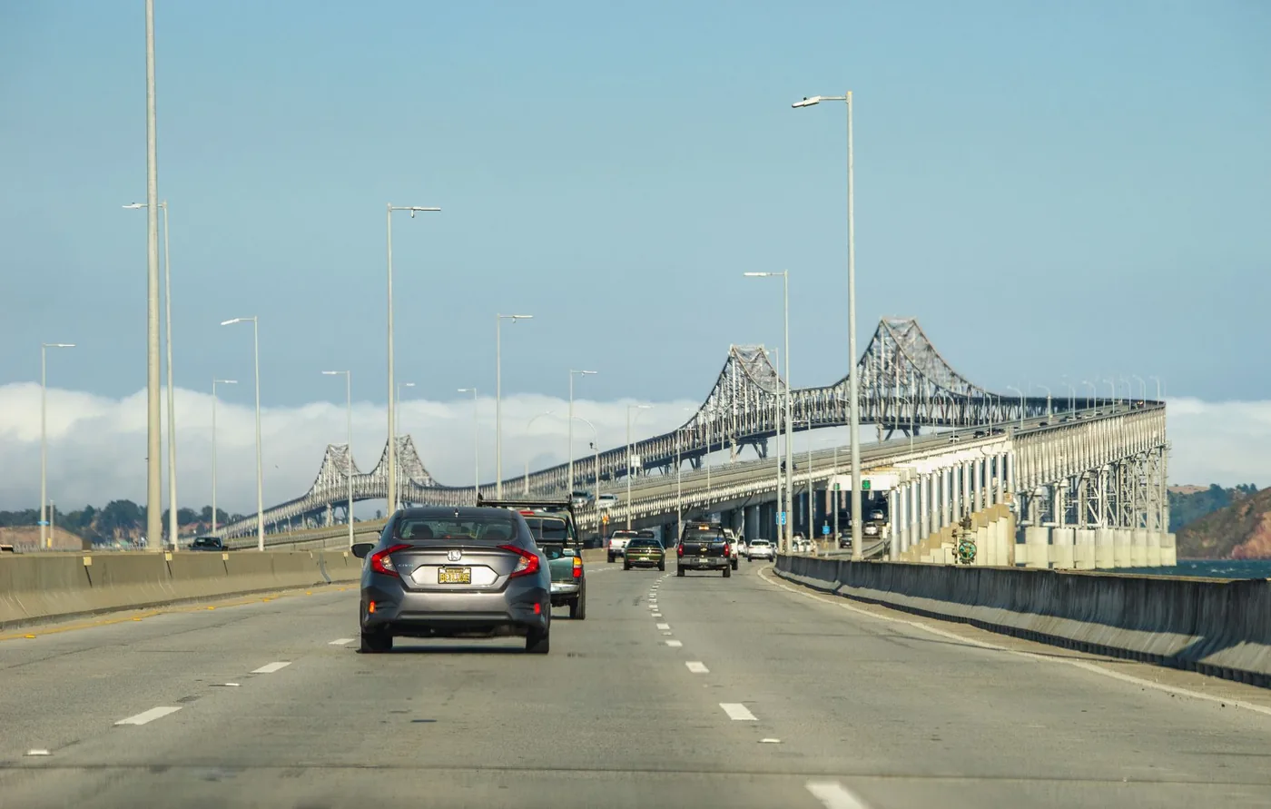
This page is for drivers transiting the Bay Area — US-101 north-south, or I-80 east-west — not for people commuting within San Francisco. Here is what the agency data says, which route actually works, and what the bridges cost.
Toll figures below were verified 8 October 2026 and expire 31 December 2026, when tiered rates begin.
No freeway goes through San Francisco
Three verified facts, and together they explain every frustrating drive anyone has had here.
Interstate 80 stops in San Francisco. California Streets and Highways Code §380(a) defines Route 80 as running "from Route 101 near Division Street in San Francisco to Route 280 near First Street in San Francisco." I-80 is 2,900 miles long, the second-longest interstate in the country after I-90, running from Teaneck, New Jersey to San Francisco — where it simply ends. There is no westbound continuation.
US-101 gives up the freeway inside the city. It arrives on the Bayshore Freeway, crosses the Alemany Maze and the Central Freeway viaduct, then exits at Mission Street onto Van Ness Avenue and runs on the surface — through traffic signals, crosswalks and a bus rapid transit corridor — before continuing via Lombard Street, Richardson Avenue and Presidio Parkway to the Golden Gate Bridge. The SFMTA confirms Van Ness Avenue is part of the state highway system and part of US-101 while being an at-grade city street. Buses averaged about 8 mph on it before the improvement project.
The freeways that would have carried you through were demolished and never replaced. The Embarcadero Freeway (State Route 480) was damaged in the 1989 Loma Prieta earthquake and closed; the Board of Supervisors approved demolition by a single vote, 6–5, and it began on 27 February 1991. The Central Freeway lost its northern elevated roadway to the same quake; Caltrans removed the section north of Fell Street in 1992 and rerouted US-101 onto Van Ness. The upper deck north of Mission came down in late 1996 and the northbound lower deck in 2003, replaced by Octavia Boulevard in 2005. About 1.2 miles of Central Freeway remains.
A city of San Francisco's size with no through-freeway is unusual in the United States, and it is the single most useful thing to know before planning this drive.
The agencies agree: San Francisco isn't where the traffic is
This surprises people, and it changes the plan.
ATRI's 2026 Top 100 Truck Bottlenecks contains zero San Francisco entries. The only Bay Area location on the entire national list is rank 72 — Oakland, I-880 at I-238, averaging 40.5 mph.
And in Caltrans District 4's calendar-2024 bottleneck table, only one of the twenty worst Bay Area bottlenecks is in San Francisco County: US-101 northbound at 20th Street, the Hospital Curve, ranked 18th with 183,176 vehicle-hours of delay in the PM peak.
The delay is in the East Bay and the South Bay. INRIX puts San Francisco at exactly the national average — 49 hours lost per driver against a 49-hour US average. The through-driver's problem here is not San Francisco traffic. It is that San Francisco has no road to take you through it.
The afternoon is clearly worse, and Thursday is the day
Caltrans District 4's Mobility Performance Report splits bottlenecks by AM and PM peak. For calendar year 2024:
Fifteen of the twenty worst Bay Area bottlenecks are PM peak. Only five are AM. District-wide, the PM peak accounts for 59% of daily lost lane-mile hours.
The worst days, in order: Thursday, then Wednesday, Tuesday, Friday.
The five worst bottlenecks, all of them outside San Francisco:
| rank | location | peak | vehicle-hours |
|---|---|---|---|
| 1 | I-680 N, Calaveras Rd | PM | 694,623 |
| 2 | I-80 E, Pinole Valley Rd | PM | 559,341 |
| 3 | I-880 N, north of Eldridge | PM | 537,356 |
| 4 | SR-85 S, Camden Ave | PM | 388,730 |
| 5 | SR-4 W, east of Willow Pass Rd | AM | 386,313 |
For a through-driver the conclusion is clean: cross in the morning rather than the afternoon, and prefer Monday to Thursday.
Four routes, and only one actually misses the city
Through the city on US-101 and Van Ness. Bayshore Freeway, Alemany Maze, Central Freeway, then surface streets to the Golden Gate. Signals, bus lanes and pedestrian crossings. Toll: $10.25 FasTrak southbound only on the Golden Gate; northbound is free.
Through the city on SR-1 and 19th Avenue. Leaves I-280 near Junipero Serra, becomes 19th Avenue — a six-lane at-grade arterial — runs through Golden Gate Park, then Park Presidio Boulevard and the MacArthur Tunnel to rejoin US-101. Also a surface route, not a freeway. It carries the Muni M Ocean View light rail in its alignment, and has been a statutory double-penalty zone for speeding and DUI since 2009.
I-280 is not a bypass. It runs 57 miles from San Jose north and ends at an at-grade intersection at King and 5th Streets in San Francisco. It does not connect to I-80. Taking it still puts you in the city.
The one route that genuinely avoids San Francisco: the East Bay and the Richmond–San Rafael Bridge. US-101 or I-880 north to I-80, then at the Hoffman Split in Albany take I-580 across the Richmond–San Rafael Bridge, which lands on US-101 in San Rafael about ten miles north of the city. I-580 passes through Marin, Contra Costa, Alameda and San Joaquin counties and never enters San Francisco. One toll: $8.50 westbound.
Two caveats. The I-580/US-101 interchange in San Rafael is incomplete — only southbound 101 to eastbound 580, and westbound 580 to northbound 101, are direct movements; the others route via Sir Francis Drake Boulevard. And the bypass has its own bottleneck: ATRI's rank-72 location, I-880 at I-238, sits directly on it.
What the bridges cost
All seven state-owned bridges charge a flat $8.50 for a two-axle vehicle, effective 1 January 2026 — the Bay Bridge, San Mateo–Hayward, Dumbarton, Richmond–San Rafael, Carquinez, Benicia–Martinez and Antioch. No cash is accepted anywhere. The rate is the same for FasTrak, licence plate account and invoice this year.
Direction matters for a through-trip: the Bay Bridge, San Mateo–Hayward, Dumbarton and Richmond–San Rafael collect westbound; Carquinez and Benicia–Martinez collect northbound; Antioch collects eastbound. So crossing the Bay Bridge into San Francisco costs $8.50 and leaving eastbound is free.
The Golden Gate charges $10.25 FasTrak, $10.50 licence plate, $11.25 invoice, effective 1 July 2026. It has been all-electronic since 2013 and takes no cash at the bridge — cash can only be paid in advance at a designated location. Southbound only, into the city; northbound is free.
One correction worth making, because many pages get it wrong: the Bay Bridge no longer has congestion pricing. The time-of-day tiers were suspended in April 2020 and have not returned. The toll is a flat $8.50 at every hour of every day. The only time-based rate on the state bridges is the carpool discount of $4.25, weekdays 5–10 a.m. and 3–7 p.m., which from January 2026 requires three occupants at all seven bridges.
Date this one in your head: 2026 is the first of five annual 50¢ increases through 2030, and from 1 January 2027 the rate tiers split — licence plate accounts pay 25¢ more and invoices a dollar more than FasTrak.
Six places it actually goes wrong
- The Bay Bridge toll plaza, westbound. Caltrans' own figures: 20 approach lanes including 16 toll booths, narrowing to five lanes downstream. Metering lights are still operated manually. That 20-to-5 funnel is the cleanest explanation of the westbound backup there is.
- The MacArthur Maze, Oakland — the I-80/I-580/I-880 interchange, about a mile east of the toll plaza, splitting Bay Bridge traffic three ways. Its single-point-of-failure status was proved on 29 April 2007, when a gasoline tanker fire collapsed a 168-foot section onto the connector below; the state estimated economic impact at roughly $6 million a day and repairs took 26 days.
- The Alemany Maze — where US-101 meets I-280 just inside the city. This is the decision point: city surface streets, or turn back toward the East Bay.
- The Hospital Curve — US-101 northbound at 20th Street, the only San Francisco location in Caltrans' twenty worst, at 183,176 vehicle-hours in the PM peak.
- Presidio Parkway — 1.6 miles of US-101 through the Presidio, opened July 2015, replacing Doyle Drive, which carried about 91,000 vehicles a weekday and was condemned as seismically vulnerable. You pass through the Main Post and Battery tunnels.
- The Waldo Grade and Robin Williams Tunnel, north of the Golden Gate in Sausalito. Two bores, the first from 1937, at the highest elevation on that stretch. In January 1982 storm landslides closed the freeway entirely for 24 hours and the northbound lanes for twelve days.
One more thing that catches northbound drivers: the Golden Gate's lane allocation changes through the day. A movable median barrier shifts across the six lanes — weekday mornings run four lanes southbound and two northbound, weekday afternoons reverse it, and off-peak and weekends are three each way. A northbound crossing on a weekday morning gets two lanes.
Find the best time to cross the Bay Area
Google Maps and Waze show live traffic once you are already driving. BoardSpy is the leave-time app: it checks your saved route before you leave, recommends when to go, and sends traffic and weather alerts for the road ahead. When you set off, it opens your map app for turn-by-turn. For how routing apps differ from departure-timing tools, see best app to avoid traffic.
Commuting in the Bay Area rather than crossing it?
This page is for through-traffic. If you drive in and around San Francisco daily, see the best time to leave San Francisco. Driving I-80 to the Bay Area from inland, see the Sacramento to San Francisco I-80 guide.
Frequently asked questions
What is the best time to drive through San Francisco?
Morning rather than afternoon, and early in the week. Caltrans District 4's calendar-2024 data shows 15 of the Bay Area's 20 worst bottlenecks occur in the PM peak and only 5 in the AM, with the PM peak accounting for 59% of daily lost lane-mile hours. The most congested days in order are Thursday, Wednesday, Tuesday and Friday.
Is there a freeway through San Francisco?
No. Interstate 80 ends in San Francisco — California statute defines its western terminus at US-101 near Division Street — and US-101 leaves the freeway inside the city at Mission Street and continues as Van Ness Avenue, a signalized surface street. The Embarcadero Freeway and much of the Central Freeway were demolished after the 1989 Loma Prieta earthquake and replaced with boulevards rather than freeways. I-280 is not a bypass either: it ends at an at-grade intersection at King and 5th Streets.
How do I bypass San Francisco entirely?
Take the East Bay. From US-101 or I-880 north, join I-80, then at the Hoffman Split in Albany follow I-580 across the Richmond–San Rafael Bridge, which lands on US-101 in San Rafael about ten miles north of the city. I-580 never enters San Francisco. The toll is $8.50 westbound. Note that the I-580/US-101 interchange in San Rafael is incomplete — some movements route via Sir Francis Drake Boulevard.
How much are the Bay Area bridge tolls?
All seven state-owned bridges charge a flat $8.50 for a two-axle vehicle as of 1 January 2026, with no cash accepted anywhere. The Golden Gate charges $10.25 with FasTrak, $10.50 by licence plate and $11.25 by invoice as of 1 July 2026, southbound only. Rates rise 50¢ a year through 2030, and from January 2027 the payment tiers split, so check before you travel.
Does the Bay Bridge have congestion pricing?
Not any more. The time-of-day toll tiers were suspended in April 2020 and have not returned — the toll is a flat $8.50 at every hour of every day, for every payment method. The only time-based rate on the state bridges is the carpool discount of $4.25, weekdays 5–10 a.m. and 3–7 p.m., which from January 2026 requires three occupants at all seven bridges.
Is San Francisco traffic as bad as Los Angeles?
No, and the data is emphatic. ATRI's 2026 Top 100 Truck Bottlenecks has zero San Francisco entries, and only one of Caltrans District 4's twenty worst Bay Area bottlenecks is in San Francisco County. INRIX puts San Francisco at exactly the US average of 49 hours lost per driver, against 87 for Los Angeles. The difficulty of driving through San Francisco is a routing problem rather than a congestion problem.