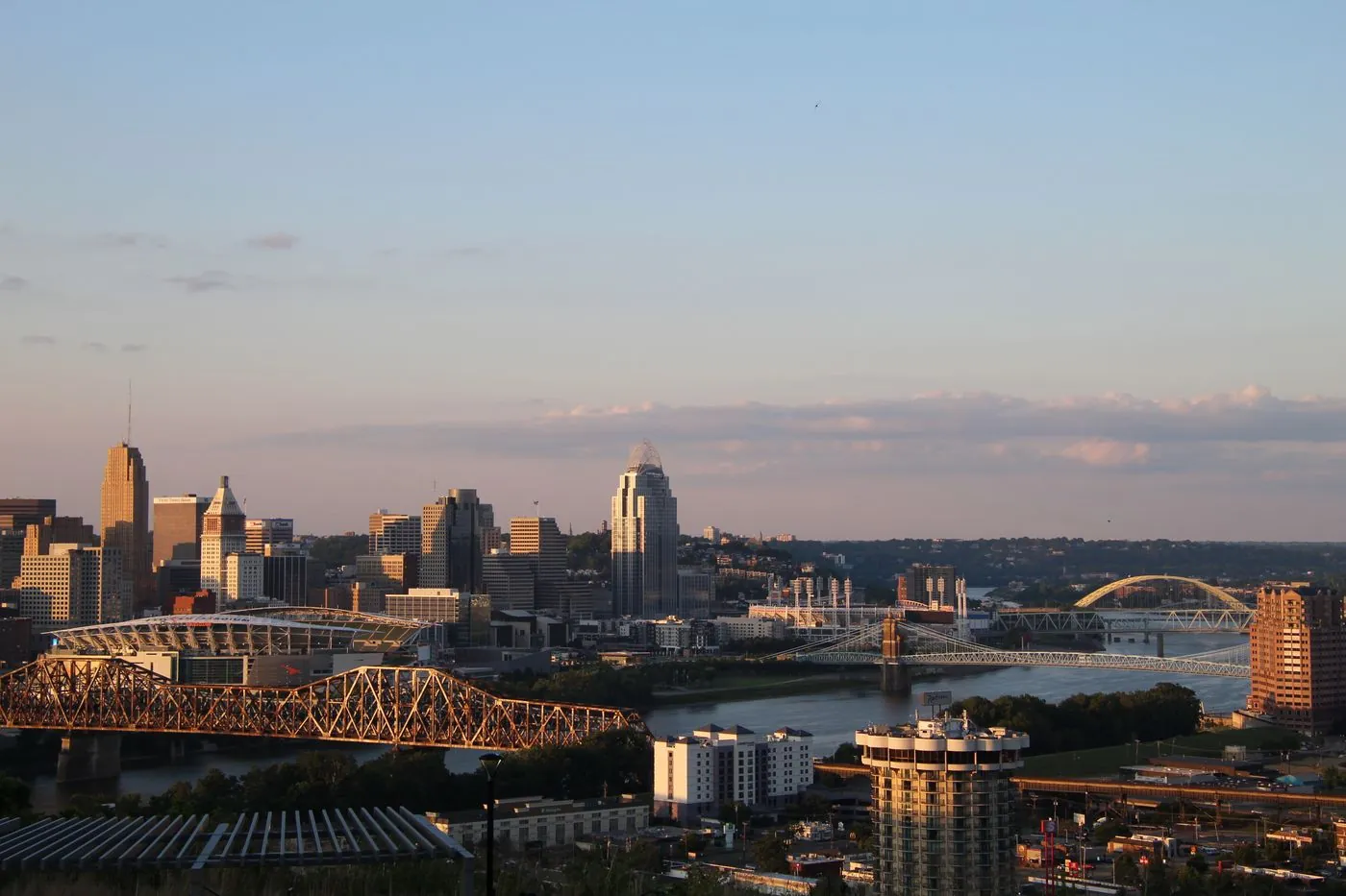
Cincinnati is a manageable drive for a metro its size, and almost all of the difficulty is concentrated in one place. Here is what the agency data says, when each corridor peaks, and how to find the best time to leave for your route.
A bridge carrying twice its design load
The Kentucky Transportation Cabinet puts it plainly in its own study FAQ: the Brent Spence Bridge "was designed to carry 80,000 vehicles per day, but is currently carrying twice that volume." A separate KYTC release gives the number: "Daily I-75/I-71 traffic has reached 160,000 vehicles in recent years."
It got there by giving up its shoulders. The bridge opened in 1963 with three 12-foot lanes per deck and shoulders of about five feet. In 1985 it was restriped to four 11-foot lanes per deck, and the shoulders went down to about one foot. Kentucky's own corridor fact sheet records both figures. The official project materials describe the result as a set of geometric deficiencies — narrow lanes, no usable emergency shoulder — while stating that the structure itself is sound and will stay in service for decades.
That matters for your commute in a specific way: on a deck with no shoulder, a breakdown is a blocked travel lane. There is nowhere for a stopped vehicle to go.
It is the ninth worst truck bottleneck in the country
ATRI's 2026 Top 100 Truck Bottlenecks, built from freight-truck GPS data, ranks "Cincinnati, OH: I-71 at I-75" ninth nationally — trucks average 42.5 mph, dropping to 35.5 mph at peak.
That location is the north landing of the Brent Spence Bridge. I-71 and I-75 run concurrently from Walton, Kentucky, cross the river together, and separate immediately on the Ohio side. So the ranked bottleneck and the bridge are the same piece of road.
Cincinnati has a second entry on that list too — rank 45, I-75/I-71 at I-275 — which makes it the only Ohio location in the national top ten and one of two Ohio entries overall.
The replacement is under way. The Brent Spence Bridge Corridor Project is a $3.6 billion programme funded without tolls, with $1.635 billion in federal grants announced in December 2022. It builds a new cable-stayed companion bridge immediately west, carrying all I-71/I-75 through traffic, and restripes the existing bridge to three lanes per deck with emergency shoulders restored for local Covington–Cincinnati traffic. Heavy construction began in spring 2026; the companion bridge is scheduled to open in 2031. Expect the approaches to change repeatedly in the meantime.
When is Cincinnati traffic worst?
The OKI Regional Council of Governments labels the windows on its own congestion map: morning rush 6:00–10:00 a.m., evening rush 4:00–8:00 p.m. Worth knowing that the agencies don't fully agree — OKI's travel-time index uses 6–9 a.m. and 4–7 p.m., and the federal measure OKI also reports uses 6–10 a.m. and 3–7 p.m. By corridor:
- The Brent Spence Bridge and the I-71/I-75 overlap — the stretch that decides everything. Two interstates on one deck with no shoulder.
- I-75, the Mill Creek Expressway — the north–south spine, running from the bridge north through the city.
- I-71 — splits from I-75 at the bridge's north landing and turns east through the Lytle Tunnel toward Columbus.
- I-275, the beltway — 83.71 miles, and it crosses Ohio, Kentucky and Indiana, with two Ohio River bridges of its own at the Carroll Lee Cropper in the west and the Combs–Hehl in the east.
- Fort Washington Way — nine-tenths of a mile of eight-lane trenched freeway through downtown carrying I-71 and US-50 together. Designed for 90,000 vehicles a day; carrying about 120,000 by 1998, before a rebuild that removed its fourteen interwoven ramps.
- Columbia Parkway (US-50) — roughly 30,000 vehicles a day inbound from the east side, per the City of Cincinnati.
Prefer a leave-by time to a set of windows? Put your arrival time into the departure time calculator and it will work out when to go.
The simple move: shift off the peak
Leaving just before or just after the busiest window clears a large share of the delay. Cincinnati's peaks are wide — OKI's own labelling runs four hours in the morning and four in the evening — so the shift needed is larger here than in a metro with sharp peaks.
The bridge is the exception to timing advice. There, what matters is whether those lanes are clear when you leave, because a stopped vehicle on a shoulderless deck is a closed lane and the delay is a step change rather than a gradual slowdown.
Four river bridges carry the interstates
The metro has roughly seven vehicle bridges across the Ohio River, and four of them carry interstates: the Carroll Lee Cropper and the Combs–Hehl, both I-275; the Brent Spence, carrying I-71 and I-75 together; and the Daniel Carter Beard — the "Big Mac Bridge," for its yellow arches — carrying I-471, a 5.75-mile spur from I-275 in Highland Heights, Kentucky into downtown.
The others are surface routes: the Clay Wade Bailey, the 1867 Roebling Suspension Bridge, and the Taylor–Southgate. The Purple People Bridge is pedestrian only.
Four interstate crossings for a tri-state metro is thin redundancy, and three of those four sit on the eastern and western edges rather than where the commute is.
Three Cincinnati-specific things that move the peak
- Three states, one commute. I-275 runs 83.71 miles through Ohio, Kentucky and Indiana — one of only two auxiliary interstates in the country to enter three states. Your drive may cross two state lines and two DOTs before you reach work.
- The Cut-in-the-Hill. The northbound I-71/I-75 descent into the river valley through Covington drops about 370 feet over four miles into the bridge approach. In 2006 the hill and bridge together recorded 272 crashes, more than seven times the rate of comparable Kentucky roads. After a 1986 runaway-truck crash, Kentucky banned most northbound tractor-trailers from the hill until 1995, and spent $50 million between 1989 and 1994 straightening the S-curve.
- Columbia Parkway sits under an unstable hillside. The City of Cincinnati spent $17.6 million between December 2019 and September 2021 drilling over 3,600 steel soil nails 30 to 50 feet into bedrock across a two-mile stretch in East Walnut Hills, after mud and debris spilling onto the road forced emergency closures — on a route carrying 30,000 vehicles a day inbound.
Why your best time is route-specific
The bridge does not peak like the eastern arc of I-275, an inbound trip is not an outbound one, and a commute that never crosses the river behaves nothing like one that crosses it twice. Citywide advice smooths over exactly the differences that decide your drive. Nationally, the worst day of the week varies by city too.
Driving the I-71 corridor northeast? See the best time to leave Columbus. On I-75 south, Louisville and Indianapolis are the next metros.
Find the best time to leave for your Cincinnati route
Google Maps and Waze show live traffic and turn-by-turn once you are already on the road. BoardSpy is the leave-time app: it checks your saved Cincinnati route before you leave, recommends when to go, sends traffic and weather alerts, and tracks delay and on-time stats including your best and worst days. When you set off, it opens your map app for turn-by-turn. For how routing apps differ from departure-timing tools, see best app to avoid traffic.
Nearby cities
- Best time to leave Columbus
- Best time to leave Louisville
- Best time to leave Indianapolis
- Best time to leave Pittsburgh
Every metro is listed on Best time to leave by city.
Frequently asked questions
What is the best time to leave to avoid traffic in Cincinnati?
Before 6:00 a.m. or after 10:00 a.m. in the morning, and outside 4:00–8:00 p.m. in the evening — the windows OKI labels as the morning and evening rush on its own congestion map. Cincinnati's peaks are unusually wide, four hours at each end, so a larger shift is needed here than in metros with sharp peaks. If your route crosses the Brent Spence Bridge, check conditions there before you commit.
When is Cincinnati rush hour?
OKI's congestion map labels 6:00–10:00 a.m. as the morning rush and 4:00–8:00 p.m. as the evening rush. The agencies use several windows for different measures — OKI's travel-time index uses 6–9 a.m. and 4–7 p.m., and the federal performance measure uses 6–10 a.m. and 3–7 p.m. There is no single official Cincinnati rush hour.
Why is the Brent Spence Bridge so congested?
It carries about twice the traffic it was designed for. The Kentucky Transportation Cabinet states the bridge was designed for 80,000 vehicles a day and now carries around 160,000. In 1985 it was restriped from three 12-foot lanes to four 11-foot lanes per deck, cutting the shoulders from about five feet to roughly one foot — so a breakdown blocks a travel lane. ATRI ranks the I-71/I-75 convergence at its north landing the ninth worst truck bottleneck in the United States.
What is the worst road in Cincinnati?
The Brent Spence Bridge and the I-71/I-75 overlap it carries. ATRI puts that convergence at rank 9 nationally, with trucks averaging 42.5 mph and 35.5 mph at peak. A second Cincinnati location, I-75/I-71 at I-275, ranks 45th. For day-to-day delay away from the river, Fort Washington Way and Columbia Parkway are the most consistent problems.
Is the Brent Spence Bridge being replaced?
Not replaced — supplemented. The $3.6 billion Brent Spence Bridge Corridor Project, funded without tolls and supported by $1.635 billion in federal grants, builds a new cable-stayed companion bridge immediately west to carry all I-71/I-75 through traffic. The existing bridge is then restriped to three lanes per deck with emergency shoulders restored, carrying local traffic. Heavy construction began in spring 2026 and the companion bridge is scheduled to open in 2031.
How do I find the best time to leave for my Cincinnati commute?
Use a leave-time commute app that reads your actual route rather than only a live map. BoardSpy recommends when to leave for your Cincinnati route, sends pre-departure traffic and weather alerts, and tracks on-time performance and your best and worst traffic days. Download it here.